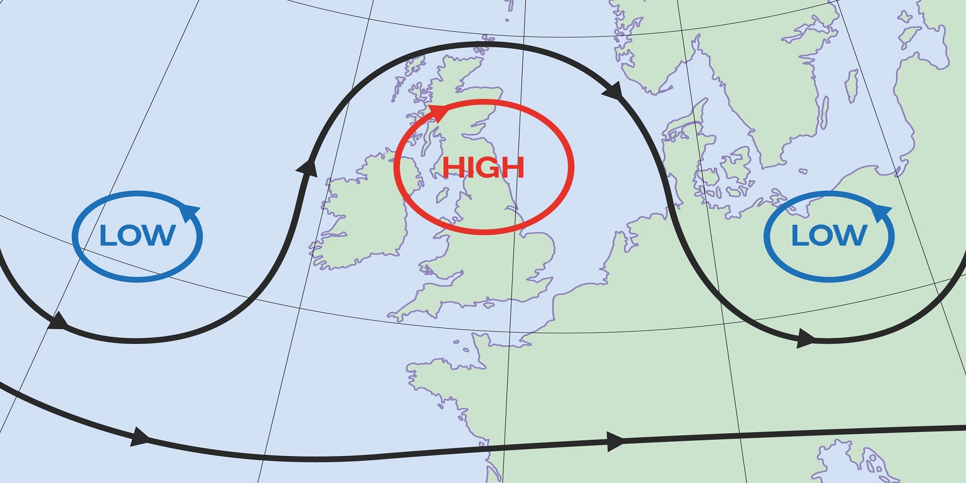
Northwest Arkansas, get ready for Summer’s scorching uppercut as she prepares to fight back! While our region’s heat waves in 2023 have generally been brief, the upcoming weather pattern is expected to cause discomfort for a protracted period of time. The jet stream is what gives the infamous the omega block pattern its name; it is shaped like the Greek letter omega.

The Omega Block Pattern Weather (Photo: Met Office)
The ‘Omega Block’ pattern weather
The phrase the omega block is not new; it is frequently covered in introductory meteorology courses. One of the many ‘blocking patterns’ meteorologists study is this one. Others are referred to as Greenland blocks and Rex blocks.
The word “block” is used to describe all of them since they all have an excessive north-to-south jet stream alignment that slows down weather patterns temporarily. The weather pattern is basically blocked that’s why it is called the omega block, which prevents weather systems from moving consistently from west to east as they generally do.
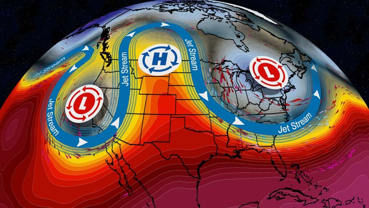
This week’s temperatures will be affected by the omega block. Cooler-than-average temperatures will be experienced early this week as a result of the two southerly plunges of the jet stream in the East and close to California. The Rockies and High Plains will experience warmer-than-average weather underneath the high-pressure ridge.
READ ALSO: “A Rapid Buildup” Pet Boarding And Daycare Flood In Washington D.C. Killed Several Dogs
The ‘Omega Block’ 2023
An area of high pressure must first move in from the Desert Southwest in order for an omega block to set up over NWA. During the Summer, we frequently encounter ridges like these, but most of the time they give way without posing any long-term problems. The jet stream pattern, on the other hand, bulges to the north when low pressure pulls in over the Pacific Northwest and the Northeast, which causes the ridge to swiftly grow. As a result, storm systems cannot dive south and affect our region, allowing stable, sinking air to dominate our weather pattern with the omega block.
Additionally, the omega block permits heat to spread quickly over a large portion of the United States, which can result in some of the warmest conditions we see in the middle of the country. As if things weren’t already terrible enough, this specific weather pattern is especially persistent in the summer when high pressure gets sandwiched between the northwest and northeastern low-pressure zones. Drought can have significant effects over a vast area of the country when extreme temperatures and insufficient rainfall combine. The chart below shows how dry it will be over the next seven days (and possibly longer) and you can plainly see the “Ring of Fire”!


