World War 2 Pictures: Unveiling England’s Evolving Landscape Through 3,600 Captured Images
Newly accessible World War 2 pictures, taken by the U.S. Army Air Forces during 1943-44, offer insights into England’s wartime landscape through Historic England’s online map, showcasing scenes of soldiers, historic sites, and revealing the impact of the war on the country.
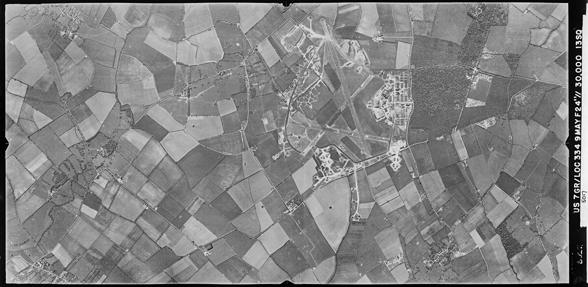
During World War II, the USAAF’s Eighth and Ninth Air Forces utilized and constructed more than 200 airfields. As expected, a significant number of these airfields are depicted in the World War 2 pictures. (PHOTO: Historic England Archive)
READ ALSO: THE DISCOVERY OF A BROWN DWARF IN OUR SOLAR SYSTEM WARMS ORBITING WHITE DWARF PARTNER
Explore England’s WWII Transformation Through Over 3,600 World War 2 Pictures
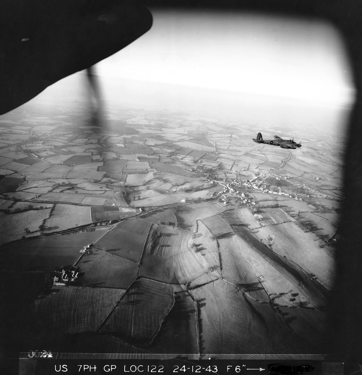
During World War II, the U.S. Army Air Forces took pictures to understand England’s changing landscape from 1943 to 1944. As reported in MilitaryTimes, these World War 2 pictures, more than 3,600 in total, are now accessible online through Historic England’s free map. Before Google Earth, this photo reconnaissance work helped the U.S. forces gather information around their bases in southern England.
The World War 2 pictures show a wide range of scenes, from U.S. soldiers playing baseball to historic sites fortified against tanks. They provide insights into how the war impacted England and the preparation needed for bombing and reconnaissance missions over Nazi-controlled Europe. Notably, the World War 2 pictures capture new airfields and military sites built by the U.S., along with towns and cities. One picture even reveals damage to Manchester United Football Club’s stadium from a 1941 bombing.
READ ALSO: $50,000 AIR FORCE INCENTIVES: NEW PROGRAM OFFERS PILOTS TO EXTEND CONTRACTS
Head of Historic England Highlights Profound Significance of World War 2 Pictures for Understanding History and Aerial Reconnaissance’s Vital Role
Duncan Wilson, head of Historic England, points out the significance of these World War 2 pictures in understanding history. They were taken by brave pilots and squads that played a crucial role in defeating Nazi Germany, even though many lost their lives in the process. The National WWII Museum stated that the U.S. military arrived in England in 1942 after Japan’s attack on Pearl Harbor, and pilots used these flights to learn and prepare for missions over Nazi-held territories.
To get the World War 2 pictures, planes used for reconnaissance had their weapons removed and cameras added. These cameras, with different lenses and focal lengths, allowed them to capture large areas accurately. These images remind us of the critical role that aerial reconnaissance played during World War II, showcasing history, geography, and the sacrifices that helped shape the outcome of the war.
READ ALSO: DISTURBING HARASSMENT BY TEACHERS TO STUDENTS EXPOSED: SAN JOSE STATE UNIVERSITY CASE






















Pingback: Indictment Exposes Alleged Police Abuse of Power: Three Northern California Officers Face Charges – Building Crypto
Pingback: Cost of Car Insurance in California on the Rise: Exploring the Escalating Concerns – Building Crypto