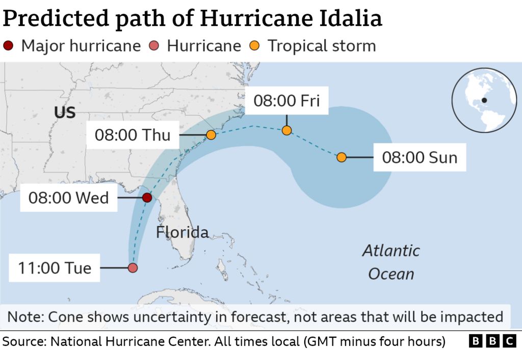
Florida’s Governor Ron DeSantis has issued a stern warning to residents regarding the impending Hurricane Idalia, urging them to heed evacuation advisories promptly as the storm edges closer to the US state. Anticipated to make landfall on Wednesday morning, Hurricane Idalia is projected to hit Florida’s Gulf coast with the force of a Category 3 hurricane.
Impending Category 3 Storm Targets Florida’s Gulf Coast
The potentially devastating impact of the hurricane is expected to affect a significant portion of Florida, including densely populated areas like Tampa. With memories of past storms still fresh in mind, Governor DeSantis stressed the severity of the situation, revealing that the targeted area has not experienced such a formidable hurricane since the 1800s. Meteorologists have issued alarming forecasts for the approaching storm, warning of high wind speeds, substantial rainfall of up to 12 inches (30 cm), and the possibility of life-threatening storm surges reaching up to 15 feet (4.5 meters) in certain regions.
Source: Los Angeles Times
What are the Updates?
As of the most recent update from the National Hurricane Center (NHC) at 11:00 AM local time on Tuesday (15:00 GMT), Hurricane Idalia was positioned approximately 275 miles (440 km) south-south-west of Florida. The storm is predicted to intensify, with wind speeds reaching up to 125 mph (201 km/h) before making landfall north of Tampa around 08:00 AM local time on Wednesday. Governor DeSantis addressed the public during a news conference at the state’s emergency operations center, emphasizing that residents still have a window of time to evacuate. However, he stressed the urgency, stating, “But you got to do that now.” Given that the targeted coastal areas have limited experience dealing with such powerful storms, the governor’s message underlined the gravity of the situation. Historical records underscore the rarity of this potential disaster. The NHC highlighted that no major hurricane has impacted Apalachee Bay in northwestern Florida since 1851. The NHC labeled the impending storm as an “unprecedented event” for this region in a bulletin.
How’s the Preparation?
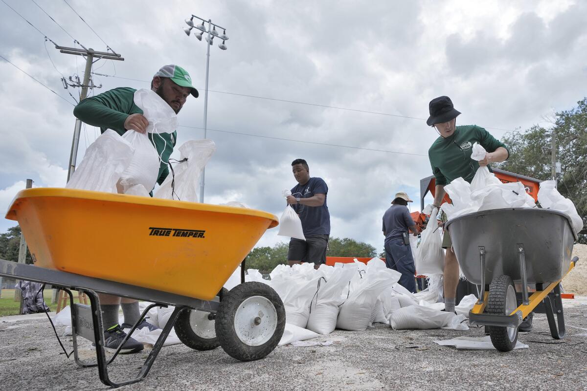
Preparations for the hurricane’s arrival are in full swing. Tampa International Airport shut down on Tuesday, with plans to remain closed until Thursday morning. Florida has activated over 5,500 National Guardsmen, and up to 40,000 linemen are on standby to address power outages. To facilitate evacuations, tolls along evacuation routes have been waived, and a substantial reserve of 420,000 gallons of fuel is on standby at gas stations. The memory of Hurricane Ian, which struck southwestern Florida last year, causing over $100 billion in damages and claiming more than 100 lives, looms large. David DeCarlo, director of Hernando County Emergency Management, highlighted the potentially devastating consequences, noting that the storm surge could result in significant destruction of homes and infrastructure, making it a “life-impacting storm surge.”

Source: Texoma’s Homepage
Historical Rarity, Preparedness Measures, and Climate Change
Hurricane Idalia’s recent impact on Cuba underscores its strength, with tens of thousands of residents evacuating in anticipation of flooding and strong winds. The storm left its mark on the island, particularly in the small fishing village of Guanimar, south of Havana, where floodwaters reached knee-height within homes. The storm’s reach extends beyond Florida, with the US states of Georgia, North Carolina, and South Carolina expected to experience heavy rainfall. In the eastern Atlantic, Hurricane Franklin, the first major hurricane of the season, could pose storm surges for the US East Coast and Bermuda. Although the exact relationship between climate change and tropical storm frequency remains unclear, warmer sea surface temperatures are believed to fuel hurricanes by providing more energy for their development. Consequently, the resulting storms are likely to be more intense and produce extreme rainfall, posing heightened risks to affected areas.


