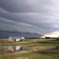
The biggest threat from an approaching potent storm will be damaging winds that could cause power outages.
- New update – Powerful Storm Takes Aim: Here’s Latest Timing For Strongest Wind Gusts, Heaviest Rain
The massive system will move in on Sunday, Dec. 10, and continue into Monday, Dec. 11, according to the National Weather Service.
Widespread wind gusts of 30 to 50 miles per hour are expected Sunday into Monday, with stronger gusts of 60 miles per hour farther east, and up to 70 mph along the New England coast. (Click on the first and second images above from AccuWeather.com.)
“At their peak, winds could gust to 50 mph in Boston and New York City, with higher gusts of 60-70 possible on Long Island and along the southern coast of Massachusetts, including Cape Cod, Nantucket and Martha’s Vineyard,” according to AccuWeather.
The highest amounts of rainfall are forecast in the areas in the darker shade of green in the third image above, where up to 4 inches is expected with locally higher totals possible.
A Flood Watch has been issued for coastal areas from Sunday afternoon through late Sunday night.
“Excessive runoff may result in flooding of rivers, creeks, streams, and other low-lying and flood-prone locations,” the National Weather Service said. “Flooding may occur in poor drainage and urban areas.”
The day before the storm arrives, Saturday, Dec. 9, the mercury will climb to a high temperature in the mid-50s with partly sunny skies.
Sunday will be mostly cloudy and breezy throughout the day. The chance for rainfall will start in the early afternoon.
Current projections for the storm system predict the heaviest rainfall and strongest wind gusts Sunday evening and continuing overnight into Monday before the system moves out Monday afternoon.
“Travelers both on the roads and in the air could end up experiencing delays, even in areas where rain or snow is not falling,” AccuWeather.com says.
Check back to Daily Voice for updates.


